Log in
All resources
Create a design
35,787 Free Images of 1815 Maps
maps in the library of congress
old maps of new hampshire
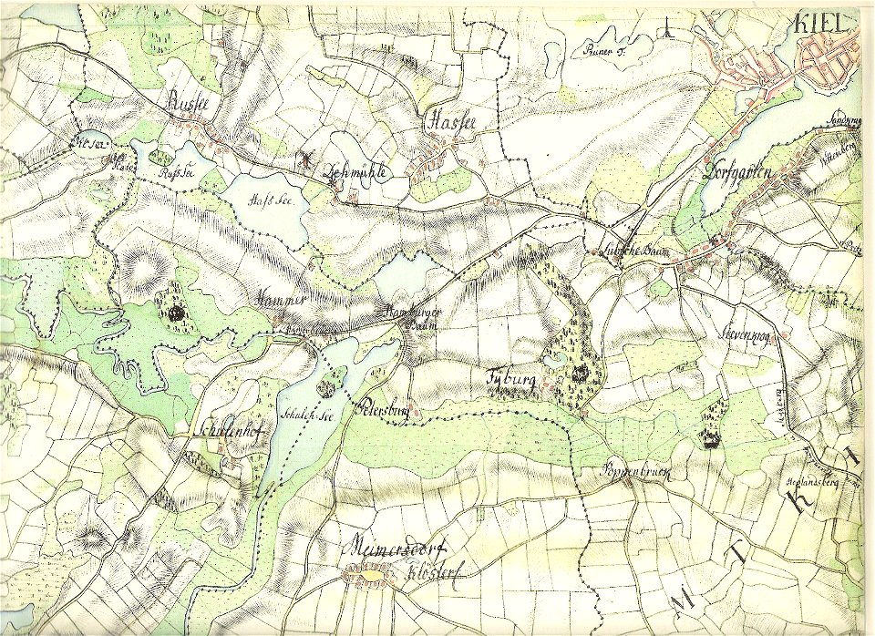
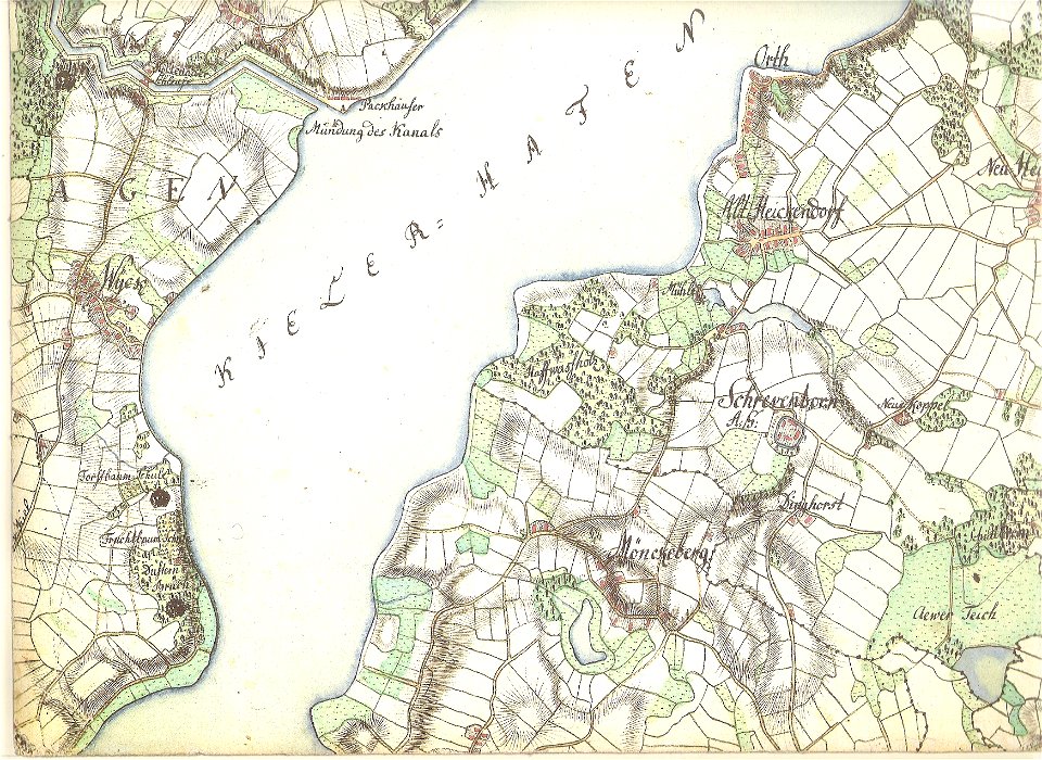
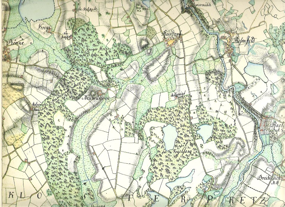
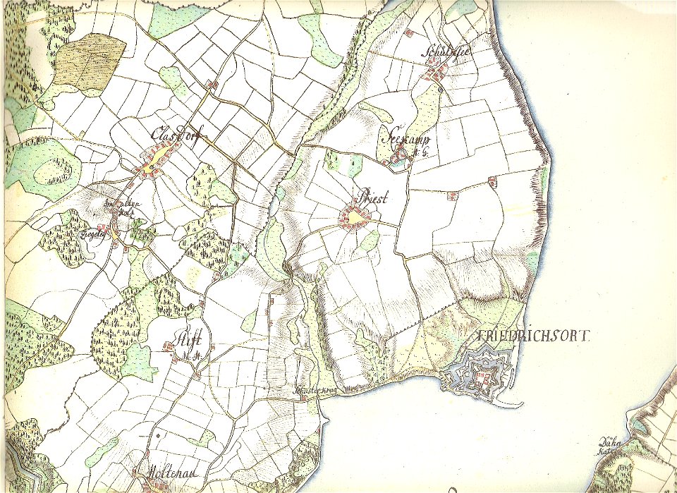
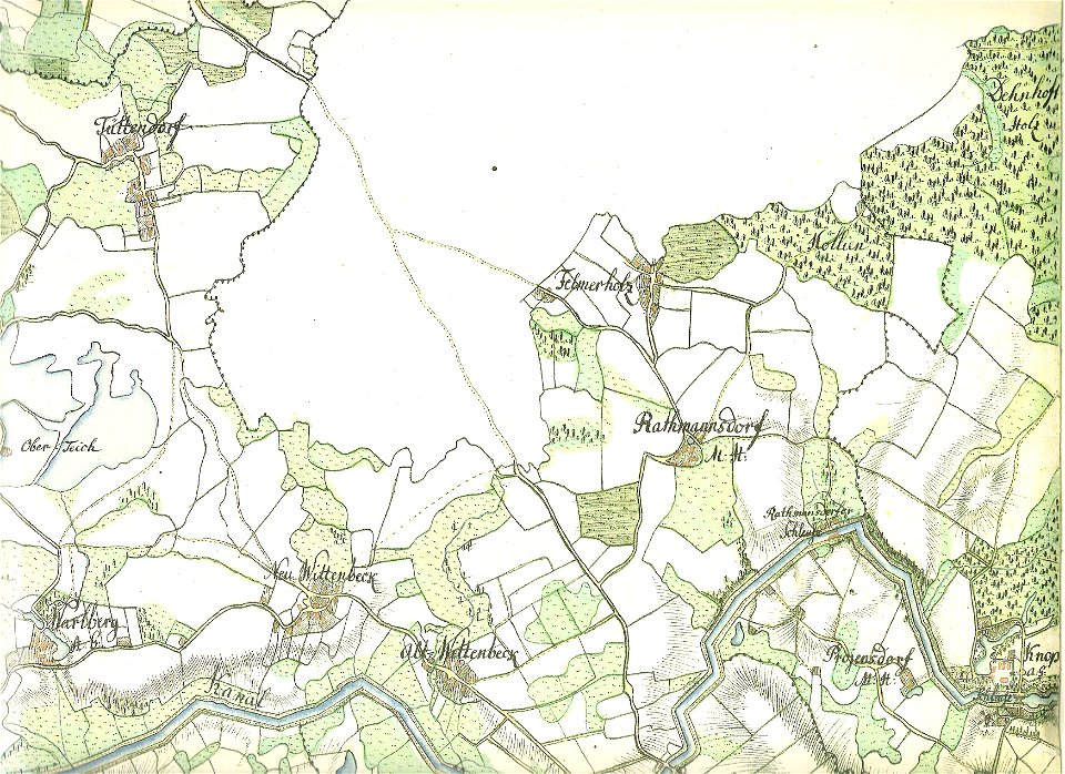
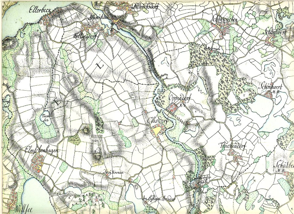
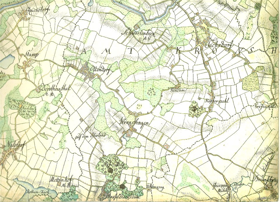
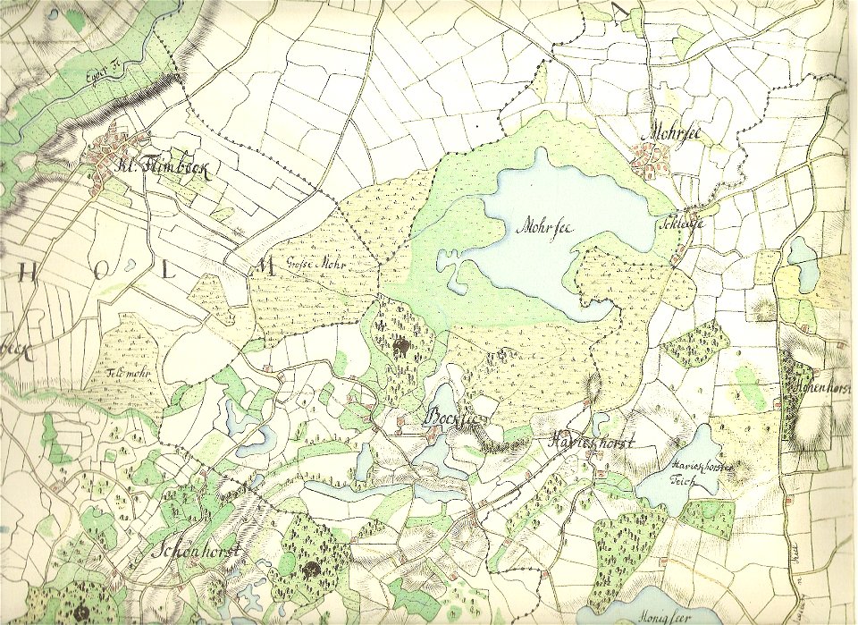
18th-century maps of schleswig-holstein
maps by gustav adolf von varendorf
old maps of kiel
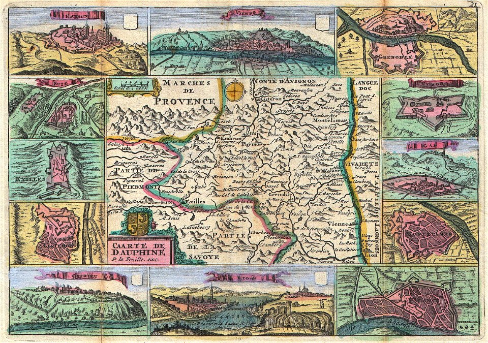
daniel de la feuille
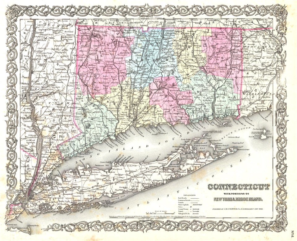
maps by joseph hutchins colton
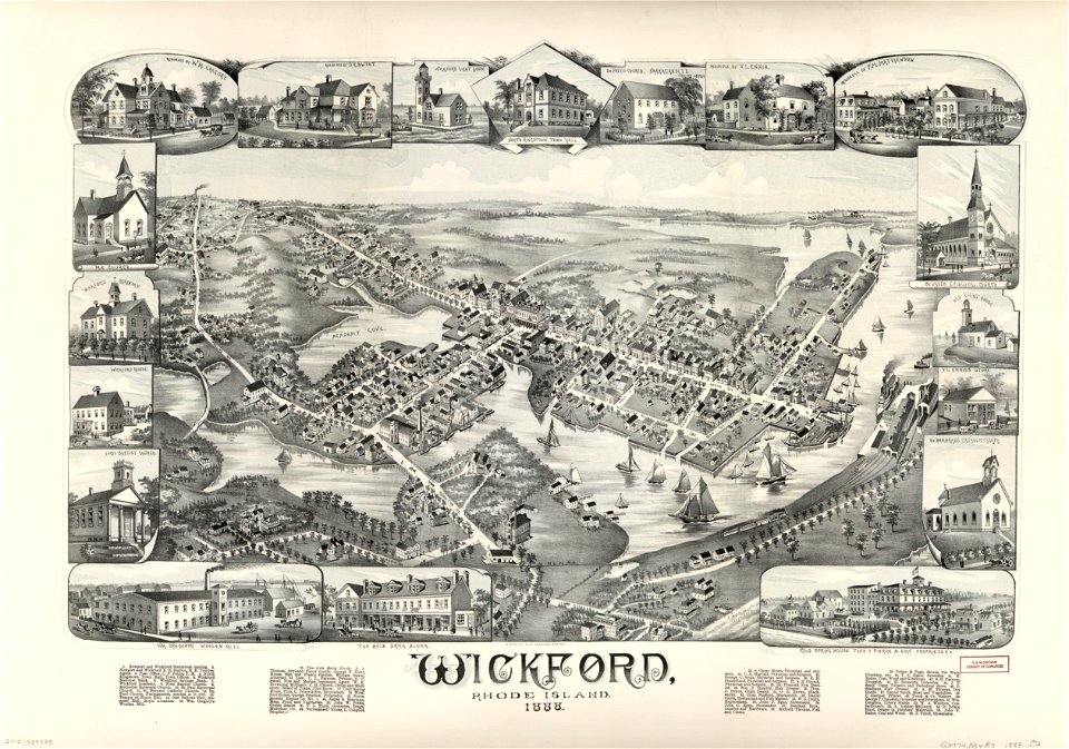
o. h. bailey
albert ruger
johannes ratelband
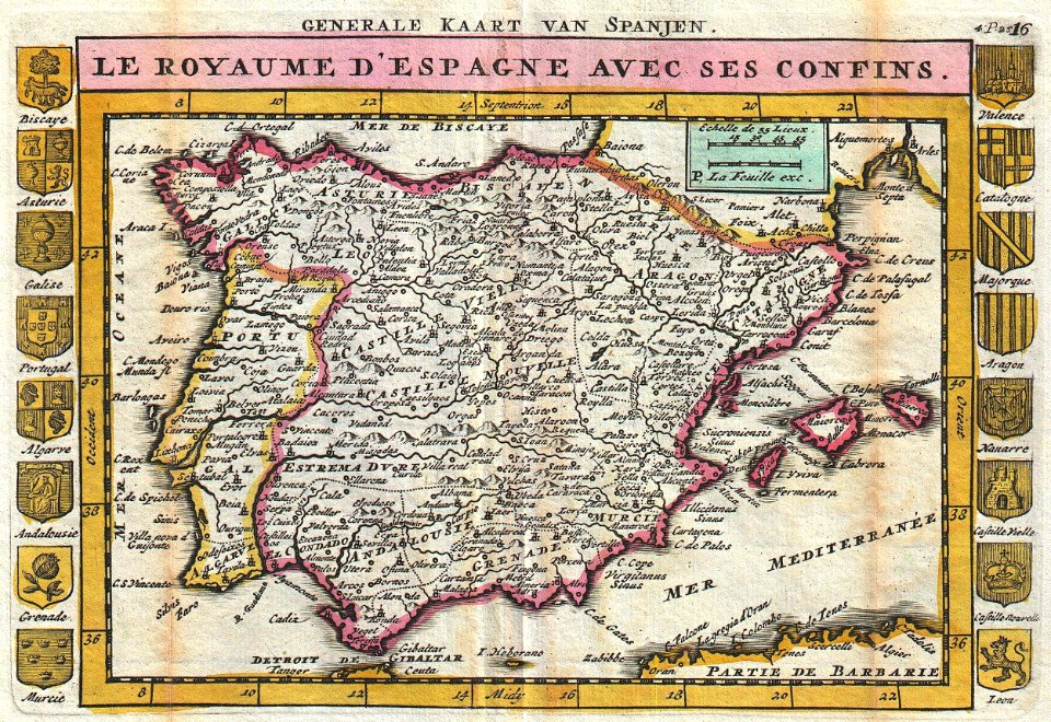
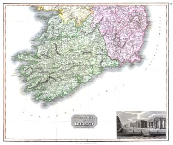
old maps of the iberian peninsula
johannes ratelband
old maps of switzerland
johannes ratelband
french-language maps
johannes ratelband
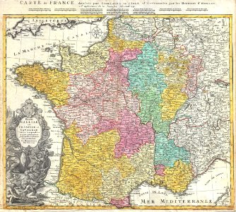
administrative history of france
johann baptist homann
16th-century maps of the black sea
coats of arms on maps
charts and maps of the royal museums greenwich
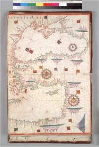
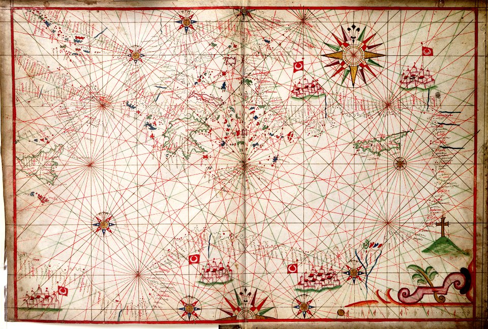
17th-century maps of the mediterranean sea
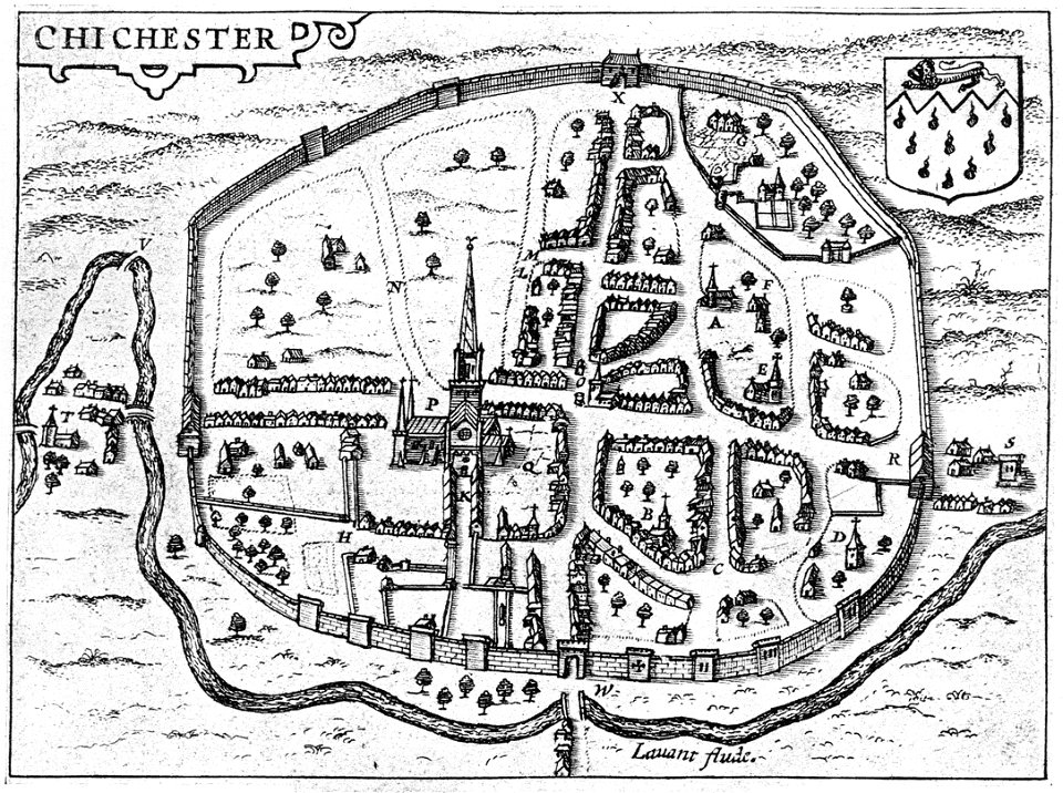
west sussex
chichester
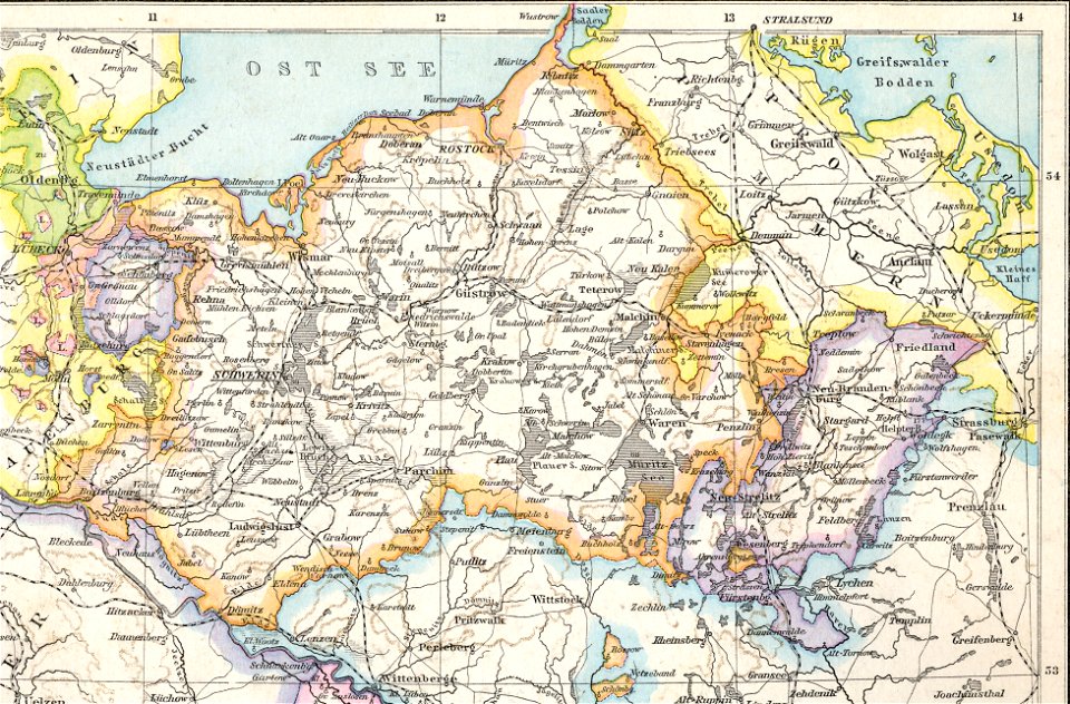
old maps of mecklenburg
1880 maps
charles françois delamarche
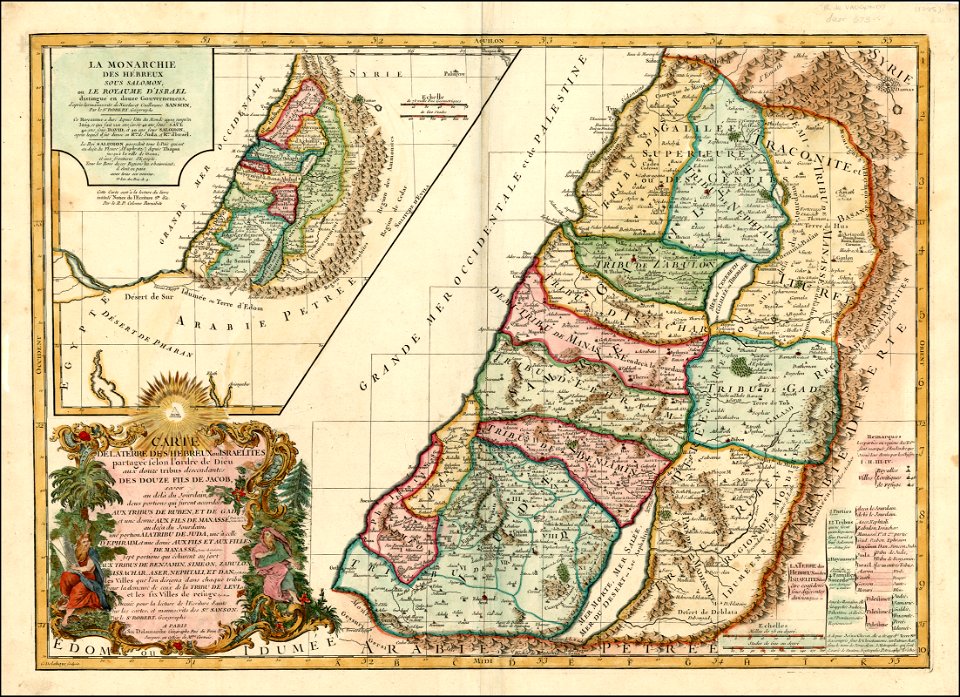
old maps of the holy land
johann baptist homann
ships on maps
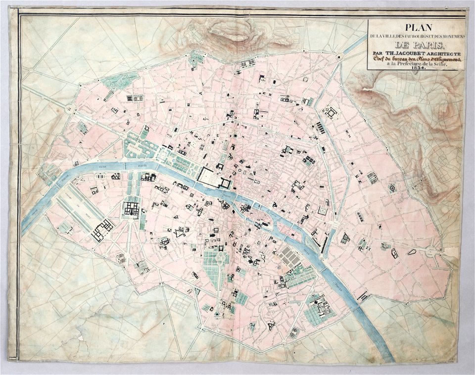
maps of paris from paris musées
1830s maps of paris
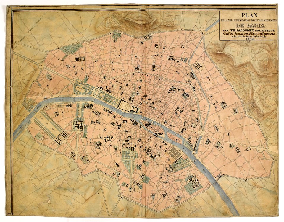
maps of paris from paris musées
1830s maps of paris
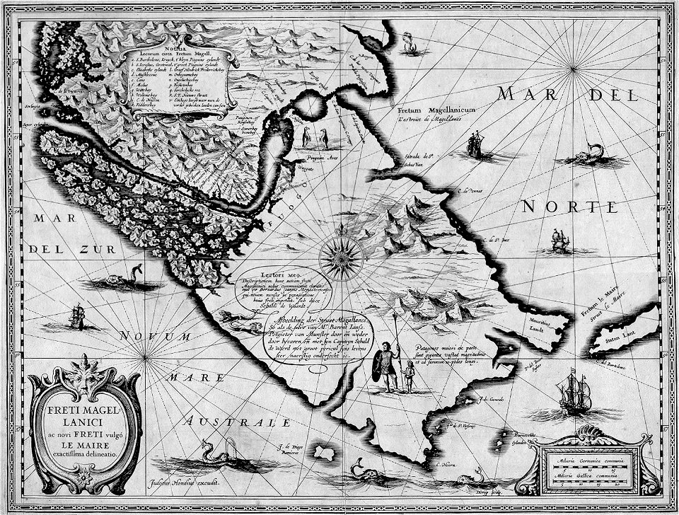
maps by jodocus hondius
1628 maps
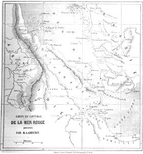
volume 6 of le tour du monde
1860s maps of eritrea
christian gottfried heinrich geißler
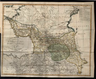
19th-century maps of the caucasus
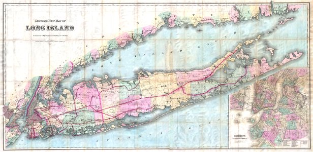
long island sound
block island
1813
1786
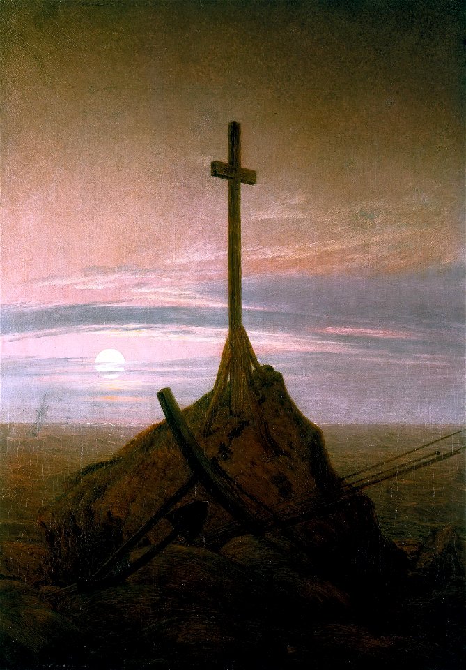
landscape paintings by caspar david friedrich
caspar david friedrich
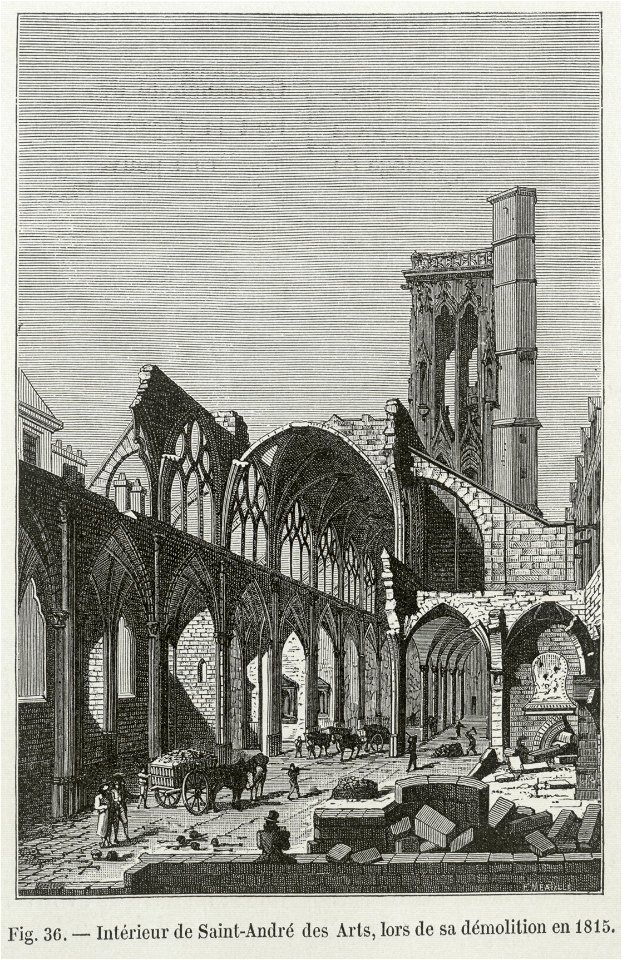
historical images of churches in paris
demolitions in paris
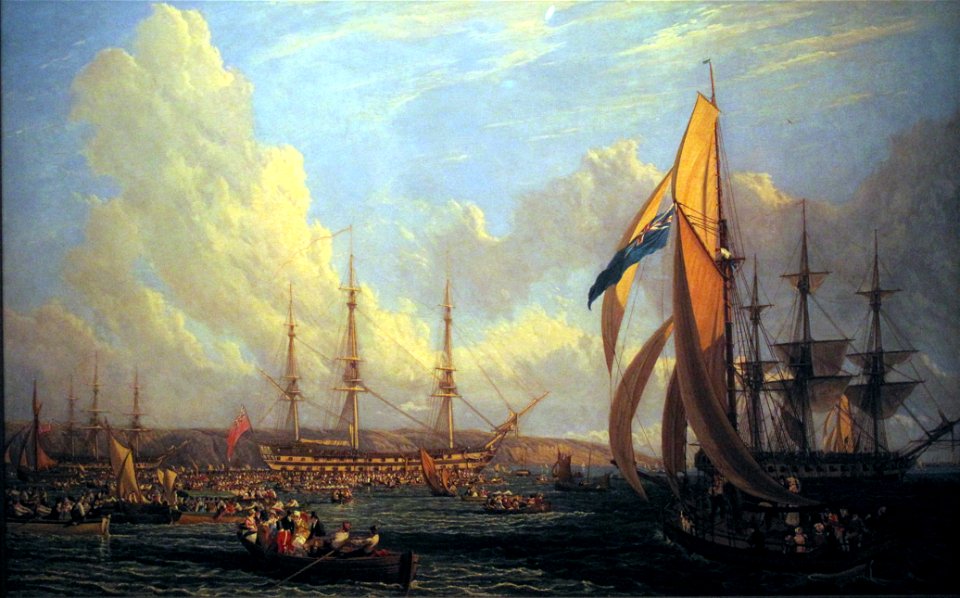
19th-century oil on canvas paintings in the united kingdom
dido in paintings
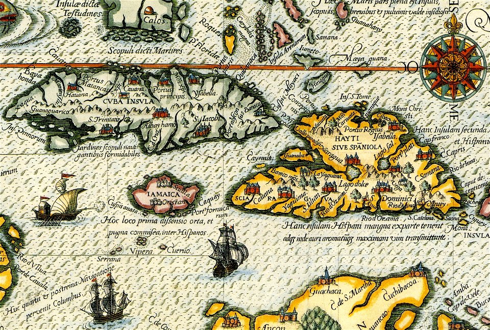
old maps of colombia
theodor de bry
rohatyn
halych
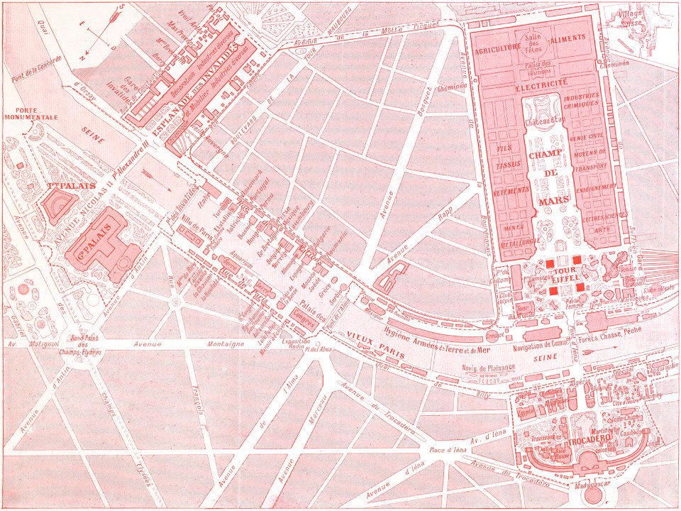
1900s maps of paris
engravings of paris
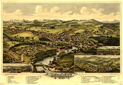
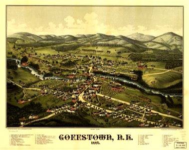
new hampshire
henniker
new hampshire
henniker
17th-century maps of the black sea
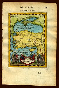
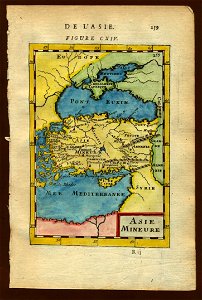
old maps of turkey
maps by frederick de wit
vollenhove
18th-century maps of schleswig-holstein
maps by gustav adolf von varendorf
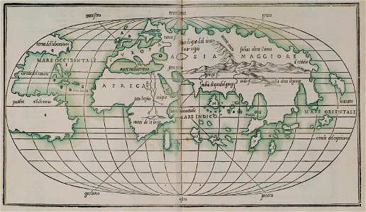
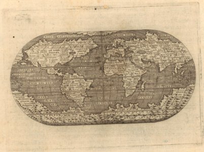
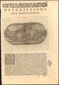
maps by benedetto bordon
1540s maps of the world
maps in the library of congress
old maps of pennsylvania
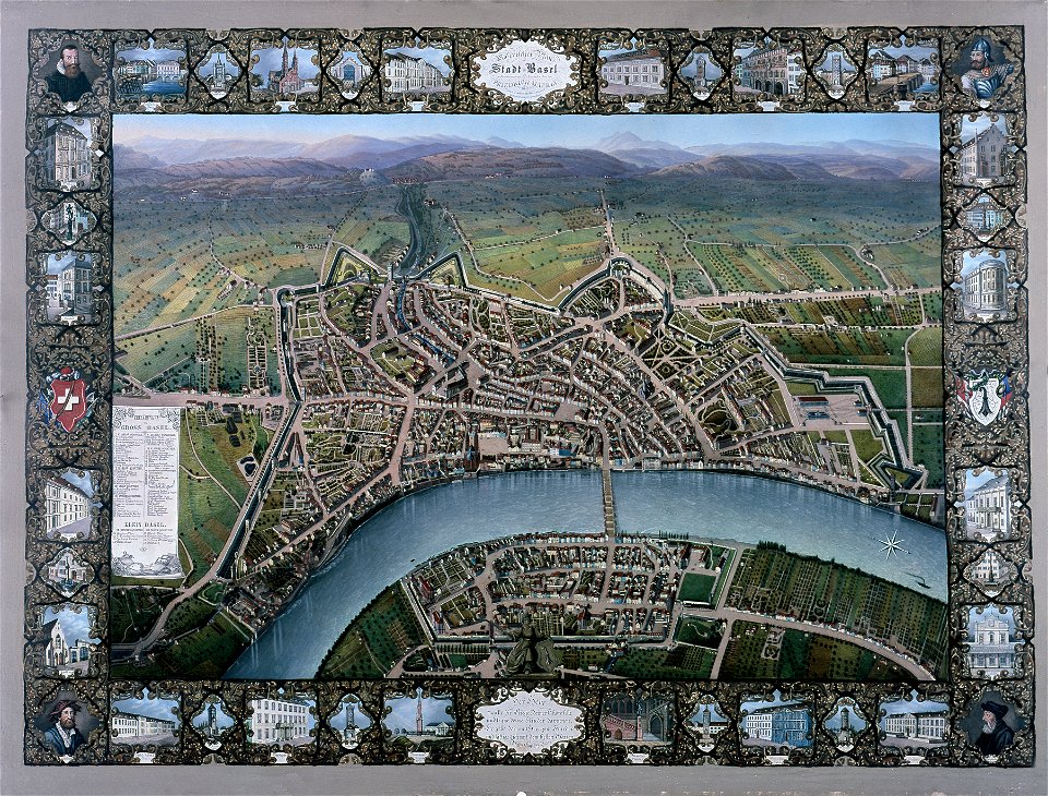
historisches museum basel
maps of basel
18th-century maps of schleswig-holstein
maps by gustav adolf von varendorf
18th-century maps of schleswig-holstein
maps by gustav adolf von varendorf
18th-century maps of schleswig-holstein
maps by gustav adolf von varendorf
18th-century maps of schleswig-holstein
maps by gustav adolf von varendorf
18th-century maps of schleswig-holstein
maps by gustav adolf von varendorf
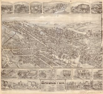
maps in the library of congress
o. h. bailey
maps in the library of congress
o. h. bailey
18th-century maps of schleswig-holstein
maps by gustav adolf von varendorf
18th-century maps of schleswig-holstein
maps by gustav adolf von varendorf
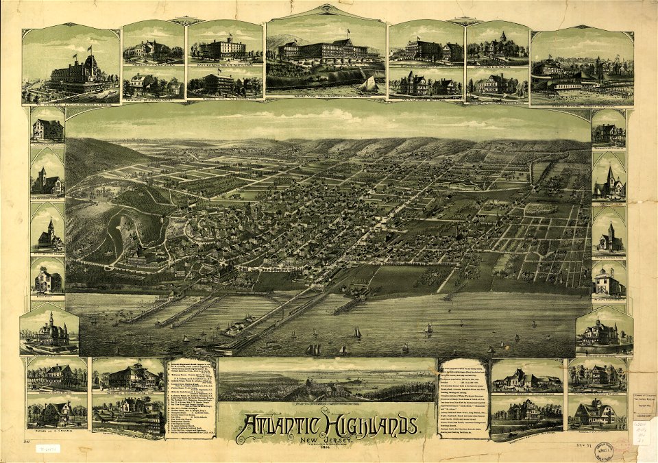
o. h. bailey
1894 maps
o. h. bailey
1894 maps
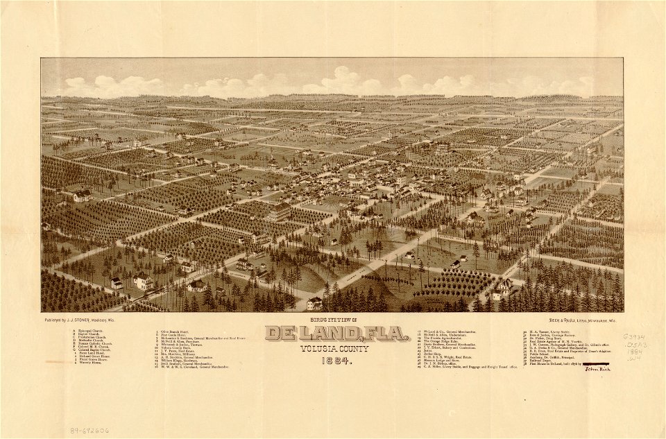
maps in the library of congress
florida
maps in the library of congress
florida
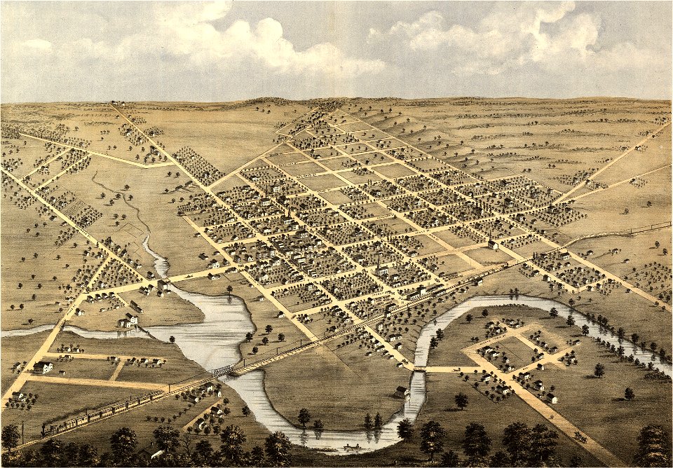
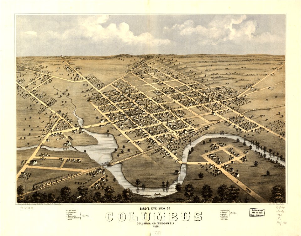
wisconsin
columbus
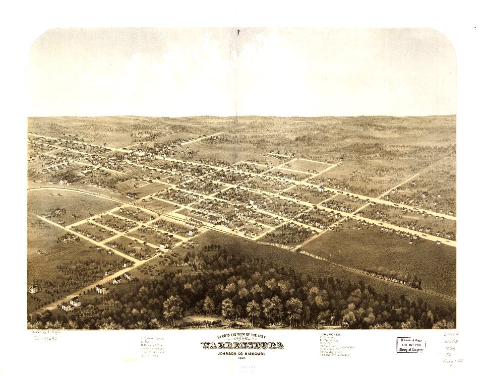
missouri
mexico
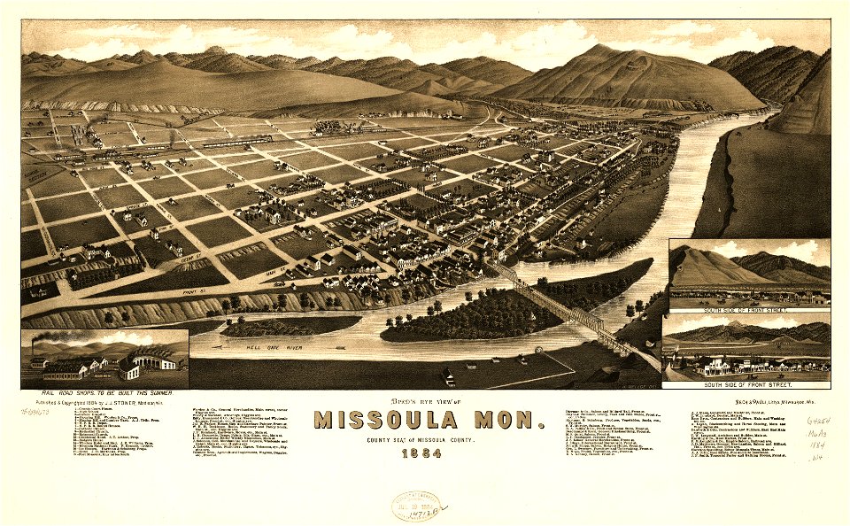
missoula
montana
wisconsin
columbus
maps in the library of congress
1867 maps
maps in the library of congress
missouri
missoula
montana
maps in the library of congress
missouri
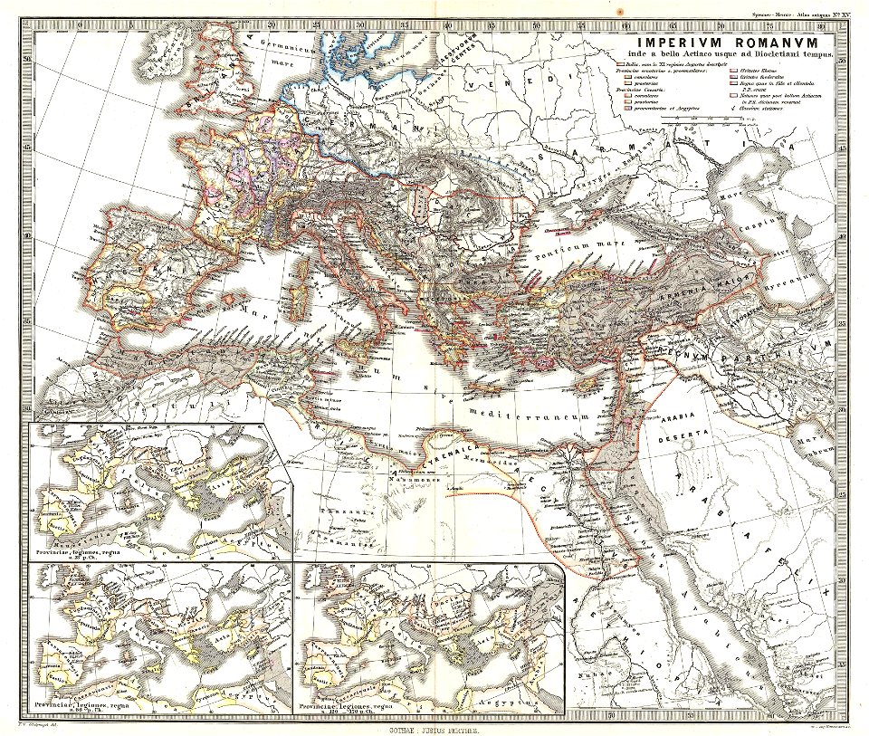
karl spruner von merz
1865 maps of europe
karl spruner von merz
old maps of sardinia
old maps of the roman empire
1865 maps
old maps of the roman empire
1865 maps
maps by joseph hutchins colton
1855 maps
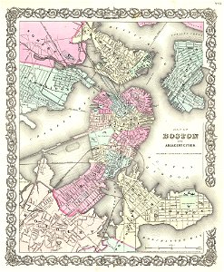
maps by joseph hutchins colton
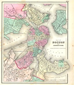
1855 in boston
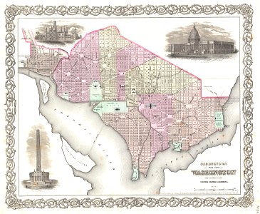
19th-century maps of washington
d.c.,
maps by joseph hutchins colton
1857 in boston
maps by joseph hutchins colton
1880 maps of new york (state)
maps from the mechanical curator collection
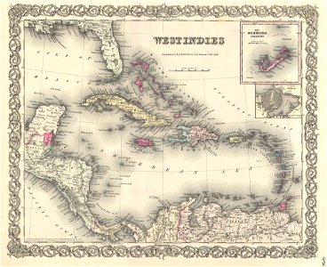
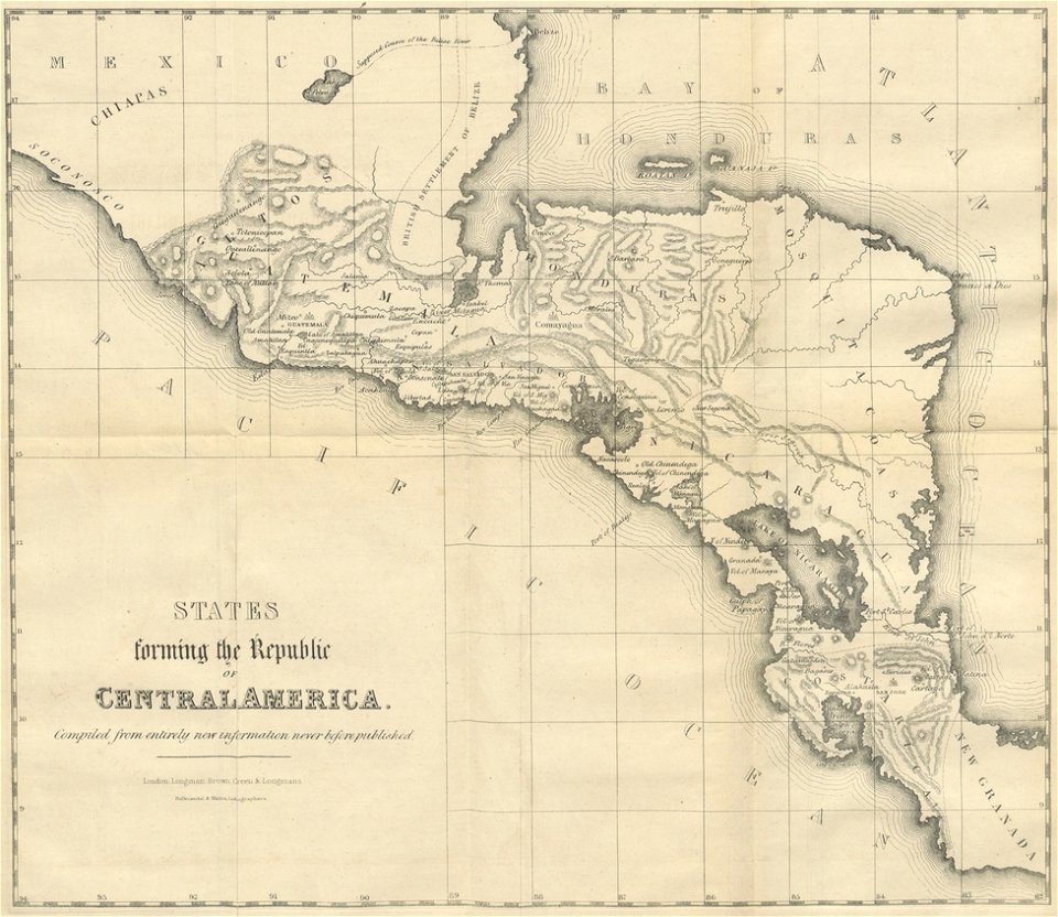
19th-century maps of central america
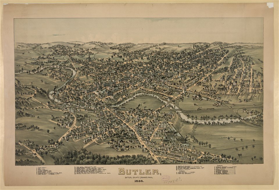
pennsylvania
butler
geographia blaviana
1659 maps
maps with cartouches
braun & hogenberg
maps by martin waldseemüller
1510s maps of the world
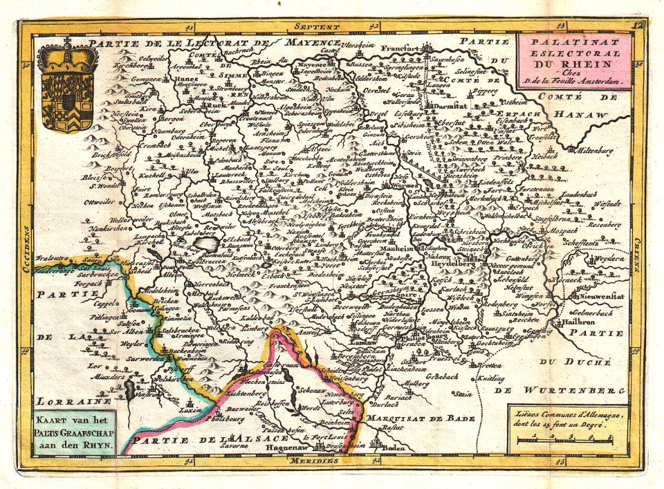
johannes ratelband
1747 maps
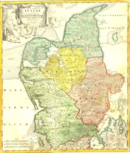
old maps of rhineland-palatinate
johannes ratelband
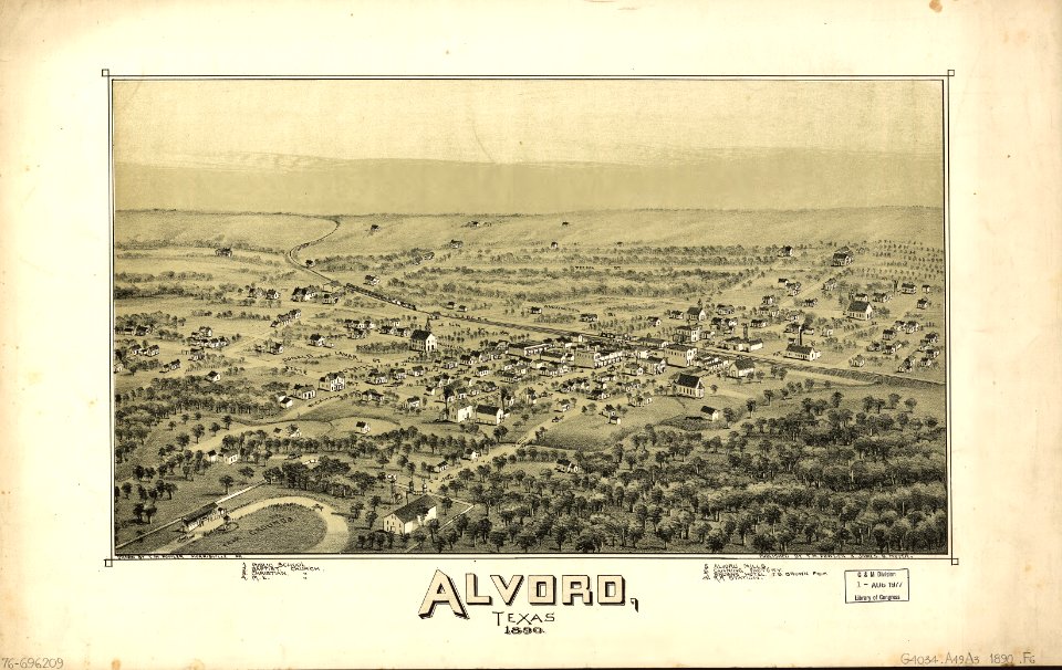
alvord
texas
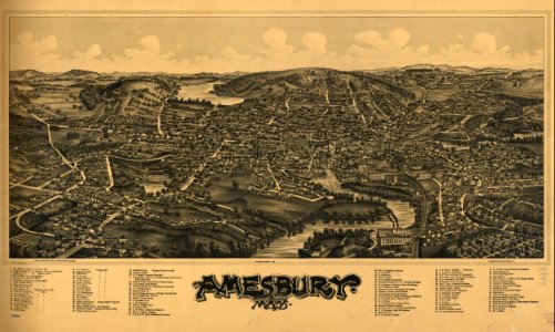
massachusetts
amesbury
massachusetts
amesbury
maps in the library of congress
o. h. bailey
maps in the library of congress
o. h. bailey
old maps of gibraltar
covens en mortier
maps in the national library of australia
1572 maps
maps in the national library of australia
1572 maps
johann baptist homann
latin-language maps
maps by willem and johannes blaeu
maps in the rijksmuseum amsterdam
maps in the library of congress
old maps of mexico
maps by jacques-nicolas bellin
jacques-nicolas bellin
charts and maps of the royal museums greenwich
old maps of the aegean sea
charts and maps of the royal museums greenwich
old maps of the aegean sea
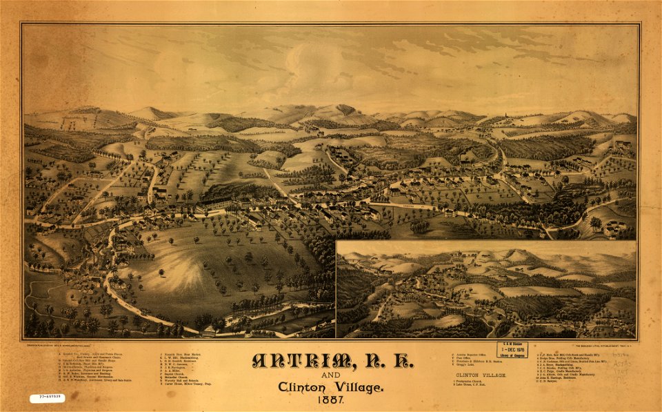
maps in the library of congress
old maps of new hampshire
maps in the library of congress
old maps of new hampshire
old maps of the arctic
1747 maps
1814 maps
dublin
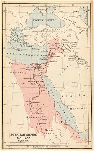
maps of the egyptian new kingdom
history of north africa
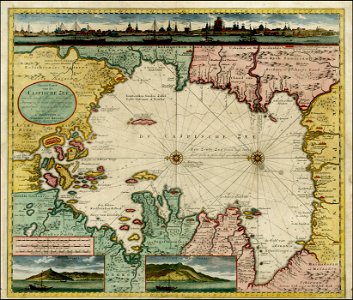
old maps of the caspian sea
1720 maps of georgia
17th-century maps of the black sea
old maps of turkey
maps by benedetto bordon
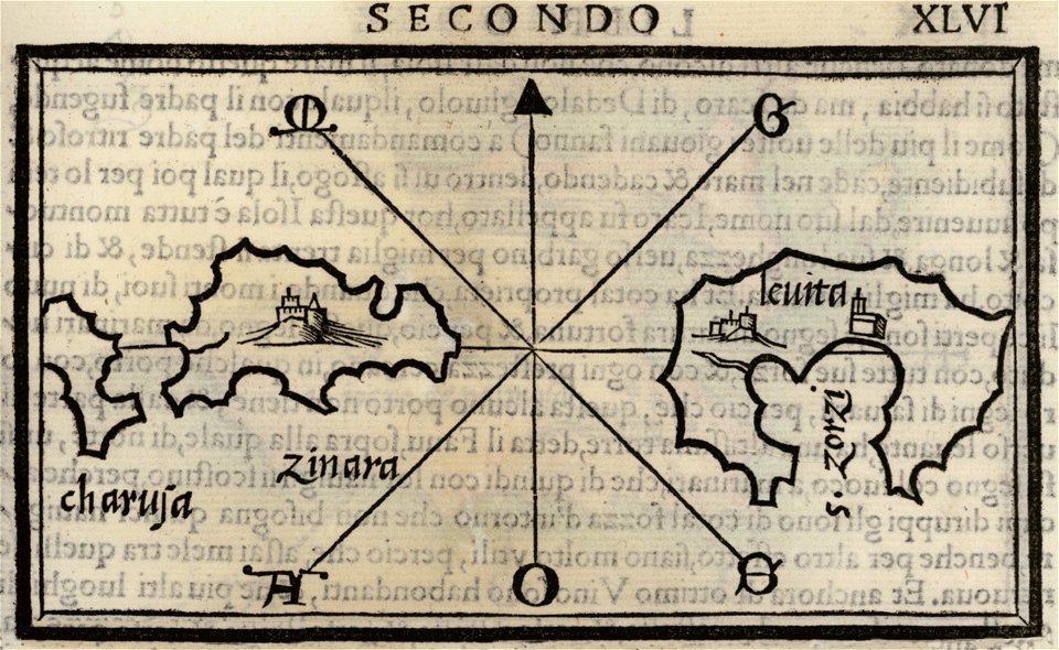
maps of leros
isolario di benedetto bordone (1547)
maps by benedetto bordon
maps in the library of congress
old maps of new hampshire
estate maps in the national library of wales
estate maps
maps in the library of congress
old maps of new hampshire
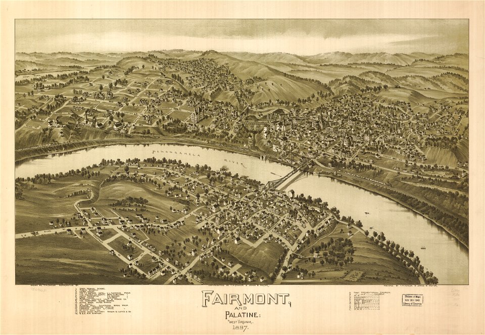
maps in the library of congress
west virginia
maps in the library of congress
west virginia
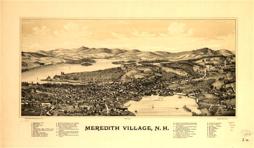
new hampshire
meredith
new hampshire
meredith
johann baptist homann
1717 maps
johann george schreiber
old maps of saxony
2601 - 2700 of 35,787
Next page
/ 358